Kivista Geo Services
GIS Application Development and Customization
Kivista's Geo team has extensive experience in all aspects of geomatics, including theoretical aspects of geography and cartography, technical expertise with GIS, database management, image analysis and programming with several "stacks". With over 30 years experience in "geo", our team can help build your team's capacity to deliver!
Practical Technical Expertise
- GIS Project Planning and Project Team Leadership
- Requirements Analysis
- GIS Applications Design and Development
- Cartographic Design (static and dynamic maps)
- Enterprise and Web System Design and Development
- Geoprocessing, Spatial Analysis and Data Management
Our Approach to Serving You Best
- We are healivly influenced by Roger Tomlinson's project planning process, which starts with defining the organization’s purpose and what mission GIS can fulfill. Even on small projects, if we don't know the strategic purpose of your project, we will ask!
- Then we want to understand and articulate the information products your information system will need to produce, and who is using that information to make decisions.
- If we had to name our project style, it would be a spiral methodology. Agile is a bit to unstructured, and classic waterfalls are hardly ever real. We work on prototypes, then improve and test, and we are done when the tools produce the information products. Oh, and when our documentation to you is awesome.
What a Long Strange Trip It's Been
Sun Microsystems => Arc Macro Language => Avenue => ArcObjects IMS => HTML/JS/CSS => C++ C# => Python => API's and Services => Arcade => GitHub => Azure and AWS
ArcGIS Pro Desktop Customization
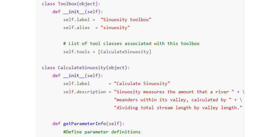
Python Toolboxes and Tools
Python Toolboxes are geoprocessing toolboxes that are created entirely in Python. A Python toolbox and the tools contained within look, act, and work just like toolboxes and tools created in any other way
Read About ArcGIS Pro Python Toolboxes
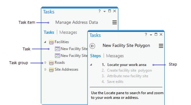
ArcGIS Pro Tasks
Tasks are a good choice for standardizing workflows. Tasks can walk you through a series of steps in a consistent manner, while still allowing significant user interaction with map data, tables, and prompts
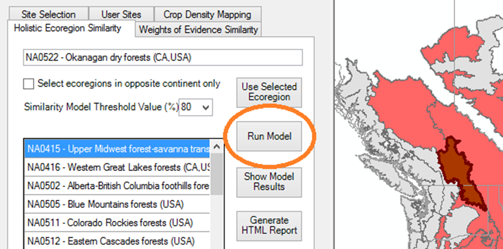
ArcGIS Pro Addin Design and Development
Add-ins are authored using .NET along with Esri’s Desktop Application Markup Language (DAML)—an XML language created by Esri. DAML describes the customizations; .NET classes provide the custom behavior. Add-ins customize the user interface, providing a new tool or set of tools that appears on the Add-In ribbon tab, other tabs, or other areas of the application such as custom panes